Boone Greenway
If you only try one trail, make it the Boone Greenway.
This fully accessible trail is either paved or gravel, and mostly flat. The Greenway welcomes walkers and runners, cyclists and wheelchairs, strollers and hikers. It follows and crosses the South Fork of the New River through open meadows and colorful forests. There's a historic ruin, plentiful resting benches, picnic tables and shelters, and interpretive signs about natural and human history. Two easy loops invite a quick stroll, one of them, with great bird-watching and flower-viewing.
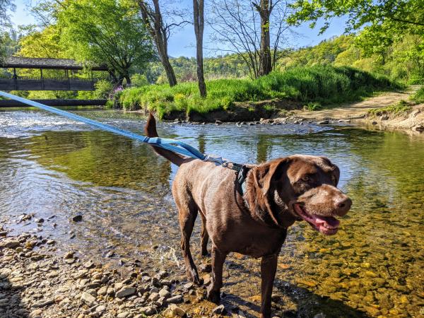
The trail may be a little tame for serious hikers intent on high adventure, but it's perfect for novice hikers, families, or anyone wanting to sample the beauty of the Boone Area without going to extremes. Dogs must be on a leash (and picked up after), and rollerbladers and bikers should yield to walkers and runners.
FIND THE TRAILHEADS
The best in-town trailheads for the core greenway area are the Watauga County Recreation Complex and adjacent Clawson Burnley Park. Turn off State Farm Road onto MLK Jr. St. Turn left just beyond the Watauga Community Recreation Center (231 Complex Drive) to park, or park to your right, by the sports fields.
Get closer to the river, bypassing the National Guard Armory (on your right) to make a left into Clawson-Burnley Park (355 M.L.K. Jr. St) Not far away, near Watauga Medical Center on Deerfield Road, there are additional parking spots for a paved loop that connects to the Greenway.
The trailhead at the opposite, most rural end of the Greenway, beside the Boone Wastewater Treatment Plant, is easy to reach from U.S. Highway 421. Head east on US 421 out of town past the New Market Shopping Center and the NC 194 intersection. Turn right just before the New River Bridge on New River Hills Road. Curve around with the river and turn left across a low-water bridge at Casey Lane. Parking is on the right.
The most urban part of the Greenway is accessed behind Southgate Shopping Center, near Lowes Hardware, other shopping, and dining.
TAKE THE HIKES
Core Boone Greenway
The core part of the Boone Greenway is a paved walking trail that extends over three miles from Casey Lane to the Southgate Shopping Center. The path explores an almost backcountry watershed tucked between neighborhoods. From many places along the greenway, surrounded by forest, green summits, and a remarkably clean mountain stream, you might not imagine that you are still in town. The trail, with three bridges, provides a wonderful barrier-free route through open fields blooming with goldenrod in late summer, past meadows, and along shady stream banks near the sound of rippling water. There is ample evidence of wildlife.
Along the trail, there is a historic site and picnic area with two tables, one with a roof. The stone ruins visible here are the remains of a hydroelectric generation station that produced the first electricity in Boone from 1915 to 1924. It served Appalachian Training School (now Appalachian State University) and 6 houses in Boone. This site sits in the middle of the woodsiest part of the trail. The plank ruins of an 11-foot-high, wood dam are still visible in the river. Another stone structure stands on the opposite bank. This early-1900s electrical generation system was the first to serve any residence or institution in the northwestern mountains of North Carolina. The station served as the basis for the New River Power and Light Company. This picnic area is reached most quickly from the Casey Lane trailhead (about 1.2 miles, round-trip).
Boone Greenway's Pocket Park
Perhaps the best parking area for the Greenway is located at Clawson-Burnley Park. The Greenway is accessible from that parking area in two places-which creates a nice 0.7-mile loop. A 0.2-mile Greenway link flanks the park south of the lot to join the main Greenway near the covered bridge (the triangle on the map on the right). Take that link, or go north a short distance on Hunting Hills Lane, cross the South Fork of the New River, and go left along a beautiful white pine-forested and paved section of trail 0.3 miles to the covered bridge. Start in either direction and make the loop using the covered bridge.
Clawson-Burnley Park is a great destination in itself, with wonderful interpretive signs about the Boone Area riverside flora and fauna, making it a nice place for nature study and birding. A handicapped-accessible picnic shelter, roofed picnic tables, and many benches afford spots to soak up the scenery.
Stroll Through Town
The more urban side of the Greenway lies south of Clawson-Burnley Park. The trail crosses MLK Jr. Street and runs past sports fields and the National Guard Armory, then along Winklers Creek to a "trail cloverleaf" at State Farm Road. The trail goes under the road to other sports fields and across the stream on the trail bridge to greenway sections that go east and west.
East (a left across the cloverleaf), the greenway parallels Winklers Creek and ends in a landscaped 0.4-mile loop at the Deerfield Road trailhead. This is a great wheelchair-accessible spot to just relax, stroll, or jog, with benches, picnic tables, and a doggy waste pick-up station.
West (a right across the cloverleaf), this side of the greenway crosses State Farm Road, following a bike lane along Furman Road past physicians' offices. The Greenway turns away from Furman Road and continues creekside (but a short continuation along Furman Road reaches the Holiday Inn Express, the closest lodging with easy pedestrian and bike access to the path). Continuing creekside, the pedestrian-only greenway goes under Blowing Rock Road (US Hwy 321/221) and exits onto Pride Drive, amid shopping centers with a dozen popular restaurants.
Best-Kept Secret Strategy:
The restaurants in Southgate Shopping Center and nearby make it easy to start your walk or bike ride at a distant greenway trailhead - and create a wonderful day trip to have lunch, refreshments, or a summertime dinner before heading back to your car. If you started at Casey Lane, this memorable day could be a nearly 7-mile round-trip.
The Kennedy Trails
The Kennedy trail system, with its woodsier gravel or dirt paths, lies on the other side of the river and is attractive to more serious hikers and beginner mountain bikers. A trail sign at the covered bridge shows the trails (accessible across the adjacent sports field on Intramural Field Rd.) There's also a connector at an uncovered bridge along the main greenway.
Help preserve these headwater trails by planning your route out ahead, keeping to designated trails, respecting deer & other wildlife that call the Greenway home, packing out any trash, and being considerate of others in the outdoors.
Click through the images below to learn more about how to help Preserve the Awe in Boone's unique environment!


