Take the Hike
Otter Falls can be reached via a series of three looping trails. Each loop is color-coded and clearly marked along the trail. Take a photo of the map at the trailhead, or download and print the map ahead of time to stay on track. The trail descends around 230 feet in elevation, with an equal climb back to the parking area. Prepare for the moderately strenuous hike with sturdy hiking shoes and expect mud and slippery rocks near the falls.
The easiest path down to Otter Falls is also the steepest descent. Soon after starting past the map at the trailhead, hikers will reach a split in the red loop of the trail. Take a right at this fork (the left fork is closed in 2025/26) to continue through the tall trees. After just 700 feet, at the first bench, the red loop intersects with the blue loop. Take another right to continue down to the falls. Another bench and the first scenic viewpoint of the trail are found another 200 feet via a short spur trail.
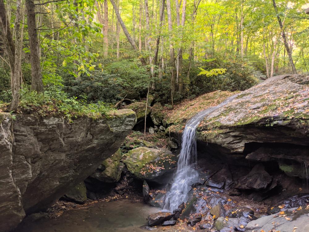
Continue back down the blue loop until it intersects with the orange and yellow trails. Another bench is found here, and a viewpoint offers a still-distant view of the falls. Take the orange trail to the right to continue towards the falls. It will fork after a short time, with the path to the right leading above the falls and the path to the left descending down to an observation deck. Go to the left first to admire the falls before continuing on the path to explore Valley Creek. The orange trail continues a short distance down the creek before looping back below the observation deck.
After carefully exploring the rocks below the misty waterfall, head back up the stairs to the observation deck and take a left to the path above the falls for a totally new perspective. Don't get too close to the edge or play in the water, the rocks are slippery here and can be extremely dangerous.
Now retrace your steps back up the trail, or continue to the yellow trail that you bypassed earlier. This trail climbs and then sharply switches back to another bench and a stunning viewpoint downstream of the waterfall. Back at the intersection of the orange, blue, and yellow trails, turn right on the Blue trail to head back via a more gradually graded path. This section of the trail peacefully winds along the contour of the road above and meets back up with the red loop at the very first bench you passed on the trail. Turn right again to continue on a gradually graded trail. At the fork in the trail, take a sharp right to ascend back to the parking area.
Help preserve these incredible trails by sticking to these designated trails, respecting wildlife, packing out any trash, and being considerate of others out in nature. Practice waterfall safety by staying out of the water above the falls, never climbing on slippery rocks, and keeping a close eye on children.
Click through the images below to learn more about how to help Preserve the Awe of the Boone area's natural wonders!

Otter Falls Park
Falls are open. The upper red trail is currently closed, but all other trails remain open. Please obey all posted signage at the falls. Otter Falls Park has a moderately strenuous looping trail system that descends around 230 feet in elevation to the scenic Otter Falls waterfall. Although...
Find Out More


