Bass Lake
A Scintillating High Country Lake
FIND THE TRAILHEAD
This hike starts on US 221 a half-mile south of the US 221/Business 321 junction in downtown Blowing Rock. From the Parkway, exit at Milepost 294.6 to US 221, and turn left toward Blowing Rock. It's a mile downhill to two Bass Lake trailheads. The first is a left turn down to Bass Lake Parking Area on the bank of the lake. Just beyond that turn, the Bass Lake parking slip is on the left side of the road.
TAKE THE HIKE
This is an extremely easy, scenic, 0.9-mile loop that is unpaved but the gravel is suitable for wheelchairs and baby carriages (no bicycles or horses permitted). Cross-country skiers will want to ski this early after snow before walkers scatter footprints (or take the less traveled side trip through The Maze; see below). The Bass Lake loop is easiest from the lakeshore parking area below US 221-a handicapped ramp descends from there past the restrooms.
Take a right out of the lot (or go left - either direction is fine). The grade weaves in and out along the grassy lakeshore amid maples that flame in fall and reaches a junction right at 0.2 mile-the 0.4-mile side trail to the parking slip on US 221. Head left across the dam, with Cone Manor visible well above the lake. Across the dam, keep left to stick to the lake loop (take the path to the right to discover The Maze, see below). Cross a span over the lake's outlet and then a second road, Deer Park Carriage Road goes right (the return leg of The Maze trail).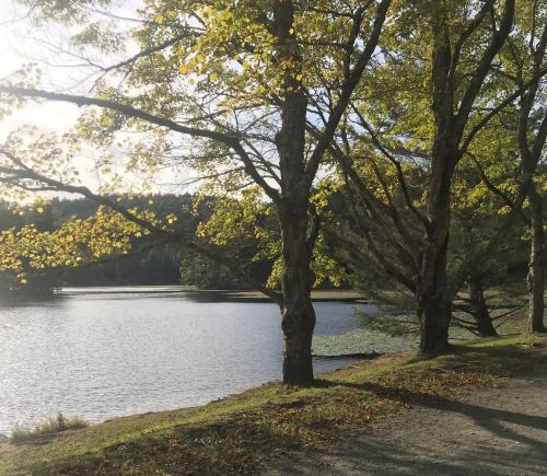
Continue left around the lake; the parking area is visible beyond an island on the opposite shore. The trail turns right and then left around the upper end of the lake where a bridge crosses the inlet brook at 0.6 mile. There's another bridge soon after, where hikers with dogs step off the trail to give their pets a drink. It's a few hundred feet back to the parking area for an 0.8-mile loop.
For a slightly longer loop, start at the parking slip on US 221. Pass an iron gate and gradually descend about 0.1 miles to a T junction. The access road to the lakeshore parking area is just to the left. Turn right to the lake 0.2 miles from your car. Turn right to cross the dam. The added access distance makes this a 1.2-mile loop.
To include a 3-mile side-trip through the Maze, turn right just over the dam and wind your mystifying way around the confusing corkscrew of The Maze. When you reach the junction at the Apple Barn in 2.6 miles, turn left. At the next junction, at 2.8 miles, turn left there on the Deer Park Carriage Road and descend to the lakeshore Bass Lake Trail at 3.3 miles. Head left there and it's a 3.6 total mile hike back to your car at either the US 221 parking slip or the lakeshore Bass Lake Parking Area.
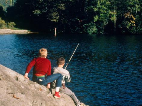
Fishing at Bass Lake
Read the sign on the trail by the restrooms and see our Parkway Fishing Guide to learn more about fishing regulations on Blue Ridge Parkway land.
LEARN MORE


