
3703 US Highway 321 S. (Note: No left turn from Boone)
LEARN MORE
![]()
![]()

On Niley Cook Rd., to the right.
LEARN MORE
![]()
![]()

1 Whitener Mountain Rd.
LEARN MORE
![]()
![]()

232 Payne Branch Rd. This small park is the former site of the historic Tate...
LEARN MORE
![]()
![]()
One more trailhead is located at the "Welcome to Blowing Rock" sign near Shoppes on the Parkway, but since the trail does not connect here yet, we would suggest starting your Middle Fork adventure at one of the other trailheads.
Download the Middle Fork Greenway Map below.
Take The Hikes
Highway 321 Trailhead & Goldmine Branch Park
A large Highway 321 trailhead, flanked by Blue Deer Cookies and Birdies Coffee & Treats, is a popular place to start hiking. Two bridges present the potential paths ahead: take the bridge to the left and walk 0.2 miles to Goldmine Branch Park. The bridge to the right's path continues for about 2 miles until it crosses underneath the road near Tweetsie Railroad and continues to its current terminus at Sterling Creek Park.
The bridge on the right crosses the Middle Fork and continues for 0.1 miles until the paved path turns into gravel. The gravel path quickly climbs in elevation, away from the roadway and into nature. At 0.4 miles, hikers or bikers will reach a resting spot and a bent wooden bridge. The trail climbs again on the other side of the bridge, past boulders, rhododendrons, and plentiful mountain laurel, until it starts to descend after another tenth of a mile.
After descending and curving sharply to the right, the trail connects to another mile of trail on the other side of the road. Walk past popular area attractions and back under the road to reach Sterling Creek Park. Turn back and stroll 2 miles back to the trailhead.
TIP: The 0.2-mile trail from Goldmine Branch Park to the Highway 321 trailhead is paved and completely handicapped accessible.
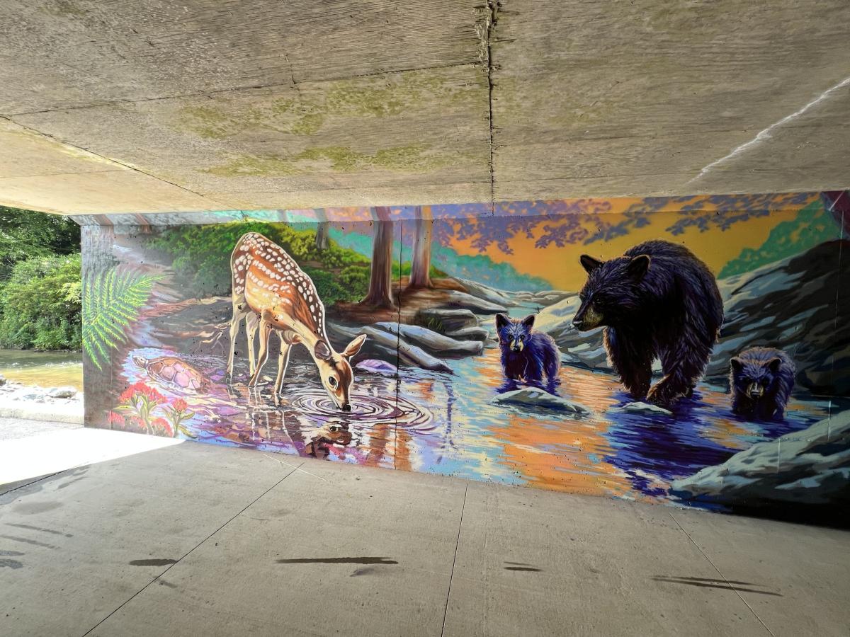 Mural painted and photographed by Whitney Landwehrmann
Sterling Creek Park & Area Attractions
It's hard to imagine you are walking so close to a highway when strolling next to Sterling Creek Park's babbling brook, surrounded by unique craft art and lush Carolina Rhododendrons. Take the path next to the stream and follow it towards the culvert beneath the highway. After crossing under the road, the path continues past Mystery Hill, a fascinating roadside attraction with a gravitational anomaly, towards the parking area for Tweetsie Railroad and High Gravity Adventures.
Cross under the highway again and connect to another mile of the trail, connecting to the main trailhead on Highway 321. In 2025, a new mural spanning the entire tunnel (pictured above) will depict the beauty of the area's natural ecosystems, created by Whitney Landwehrmann.
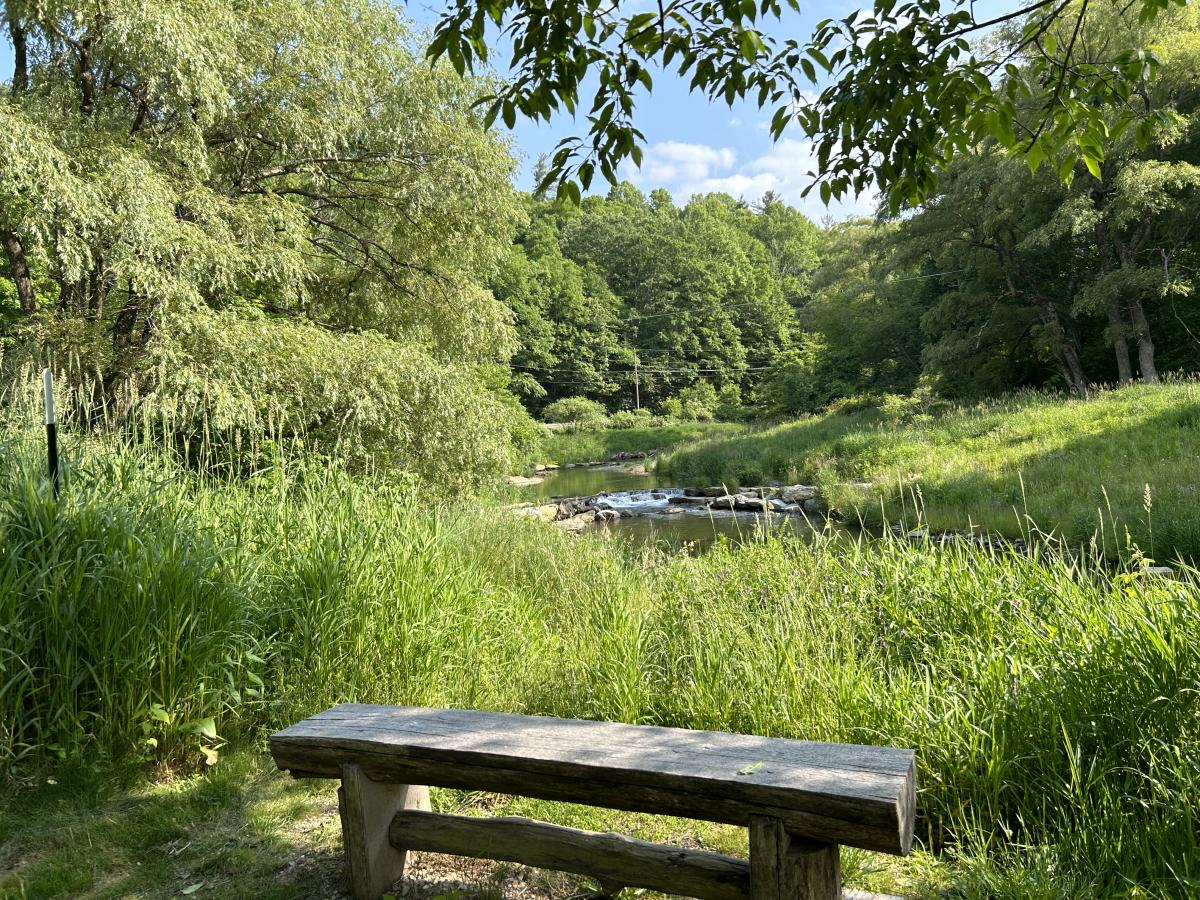
Payne Branch Park
This section of the Greenway currently has about 0.1 miles of natural surface trail. The park's resilient natural ecosystem and hydroelectric history make this area a favorite stop for fishers and hikers already. Stop at the informational kiosk to read about the history and removal process of the Historic Tate Dam and the riparian restoration efforts made by local conservancy groups. A picnic table, situated near the trailhead, makes the perfect streamside picnic spot, and benches are situated in shady spots along the trail.
Take the path to the left of the parking area to explore the widening headwaters. Several side paths along the way will take fishers down to the waterside. Stick to these side trails to protect the riparian zone.
Help preserve the Middle Fork Greenway by planning your route ahead of time, keeping to designated trails, respecting wildlife you encounter, packing out any trash, and being considerate of others in the outdoors.
Click through the buttons below to learn more about how to help Preserve the Awe in Boone's unique environment!


