New River Paddle Trail

171 Grand Blvd., Boone, NC 28607

(828) 266-1345

E-mail

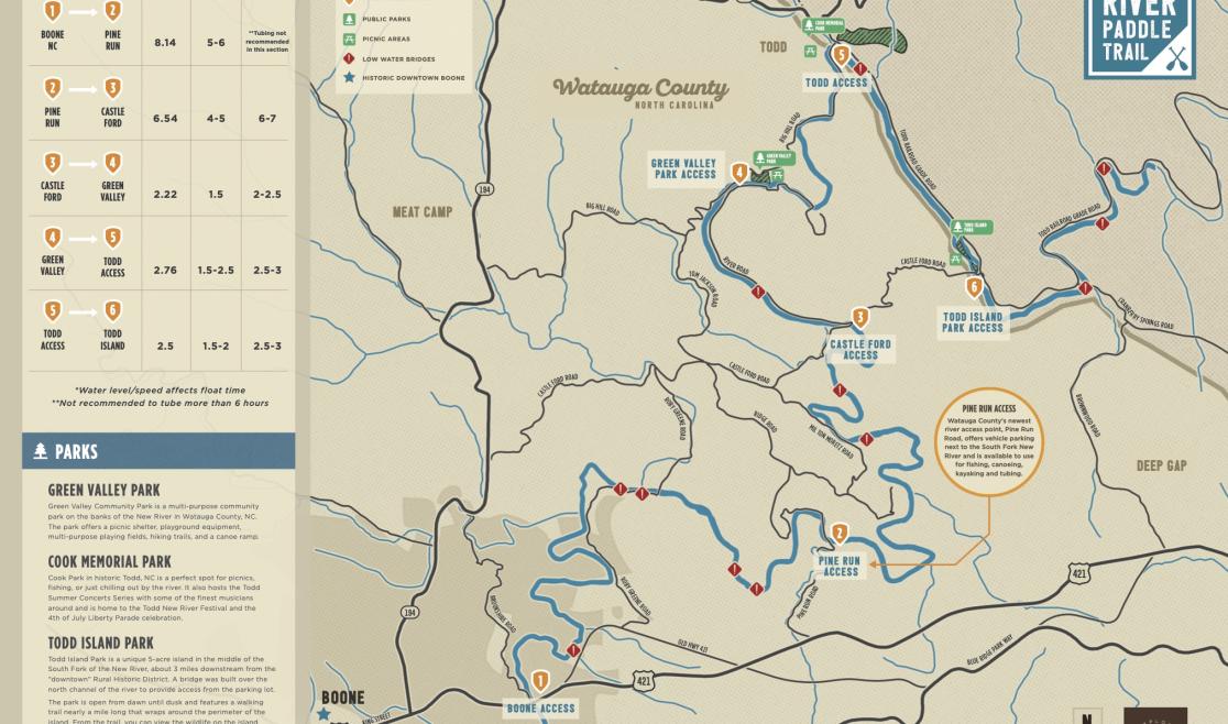
Five sections of the New River Paddle Trail offer slow and peaceful waters and wildflower-covered banks, the perfect backdrop for a self-guided canoe ride or a lazy inner tube ride on a hot summer's day. 

Make sure to set up transportation from one point on the river to the next with a local guide service or transportation service. For more tips on what to wear and how to prepare for a day out on the river in Boone, check out our Tubing Tips & Checklist.


The six river access points noted on this map can be used as put-ins or take-outs. Pick from any of the 5 sections, or combine a few, to create your perfect day on the river. Take note of the approximate distances and float/paddle times listed on the map.

Section 1: Boone → Pine Run

Typically very shallow, unless after a rain event. Paddling is the best way to experience this section, as tubing is not recommended.

Section 2: Pine Run → Castle Ford

This section can feel very “wild” with ample opportunities for wildlife sightings and birdwatching. Several low-water bridges will require paddlers to exit and re-enter the water.

Section 3: Castle Ford → Green Valley Park

Outfitters and locals frequent this section in the summertime. Note: A bridge on Castle Ford Rd. sustained damage during Hurricane Helene, detours are in place. Parking is limited to outfitters and customers at the Castle Ford access. 

(Book a trip with a local guide service and they'll take care of everything!)

Section 4: Green Valley Park → Todd

This is a great section for river tubing and is often used by outfitters and locals in summer. Note: parking in historic downtown Todd is extremely limited - it's best to use a transportation or guide service, if possible. 

Section 5: Todd → Todd Island Park*

This unusually straight section of the river parallels Todd Railroad Grade Road, which is a great spot for biking with the family. 

*Todd Island Park is currently closed in 2025. 

DANGER!

Low Water bridges are marked on the map with a “!”. Due to being very low and near to the water, these bridges can be extremely dangerous during high water activity and flood events. Be very cautious to exit the river before heading too close to allow water bridge in high water. Always check into water levels before starting your adventure.

Local weather conditions can drastically affect water flow. Plan and prepare for any whitewater excursions by checking USGS water gauges in the area.


The Paddle Trail Pocket-Sized Guide is available at area outfitters: 

-RiverGirl Fishing Co.

-High Mountain Expeditions (New River Outpost)

-Wahoo's Adventures

-River & Earth Adventures

-Mast General Store locations

-Magic Cycles in Boone

-Boone Bike & Touring

-Footsloggers

-Waypoint Outfitters

-Due South Outfitters

-Boone's Fly Shop

-Recess

-Regear

-The Jones House

-Explore Boone Visitor Center

Send us an email if you'd like a free copy of the Paddle Trails guide sent to you!